TAPESTRIES / MAP STUDIO
Maps for exploration. Frames for a story.
A shared cartographic design for the atlas, historical maps and development studies. Export the view you have chosen, with its context and source trail.
From an interactive map to a cinematic frame.
Use Map studio · export for Tapestries beneath a map. Select a view, zoom and layers first. SVG keeps paths and labels editable; the terrain is an embedded raster image. PNG produces a 3,840-pixel-wide frame, including a 3,840 × 2,160 option for film. Scene notes record the selected controls and camera information available for that map; they are a reference for production, not an animation project or an automatic replay file.
The 16:9 frame fits the whole selected view rather than cropping away places. For a closer composition, zoom the interactive map before exporting. Map geometry, names, historical uncertainty and source credits should remain together through editing.
Geography, terrain and evidence.
- Natural Earth: generalized country outlines, coastlines and river geometry. Public-domain data and terms.
- GeoNames and named local sources: town coordinates and locality records. GeoNames attribution and CC BY 4.0 terms. Follow individual map entries for UNESCO and other location sources.
- Terrain: multidirectional hillshade derived from Mapzen Terrain Tiles, using NASA SRTM / USGS elevation data in this region. Vertical relief is exaggerated threefold for orientation; it is not a survey or a reconstruction of historical vegetation. Terrain dataset credits. The wider regional layer uses zoom-6 tiles; the detailed Yorùbáland layer uses the existing zoom-9 relief.
- Satellite view: NASA imagery and its existing layer credits remain separate. Satellite tiles are not included in the Map studio export. Use the terrain maps for these reusable frames, and consult the imagery provider’s terms before using satellite imagery elsewhere.
Historical maps: carry the source with the story.
The Ọ̀yọ́ c.1780 reconstruction adapts Henry B. Lovejoy’s historical cartography, with simplified geometry and local alignment described on the map page. It is not a surveyed frontier. Source image and attribution · CC BY-SA 4.0. Retain the attribution, source link, licence and a description of modifications when reusing this adaptation.
The northern comparison brings together different periods. Bornu c.1750 draws on ArnoldPlaton’s reconstruction under CC BY-SA 3.0; the map’s source directory identifies that source alongside the Hausa, Songhai and neighbouring-polity material. Follow each layer’s source and licence. A composite export is not a blanket grant of rights over every underlying source or an assertion that all polities existed in those forms at the same moment.
Resource markers locate evidence entries, not proved reserves, operational sites or licence limits. Cultural centres do not establish exclusive ethnic territories. Dashed lines and qualifying language retain their meanings in exported frames.
Suggested production credit and reusable assets
Cartography: Olukotun.org / Tapestries. Geography: Natural Earth; locations: GeoNames and cited locality sources. Terrain: Mapzen / NASA SRTM / USGS. Historical outlines: the authors and licences identified for the selected layers. Adapted for this production; retain the relevant source links and licence notices in the production credits.
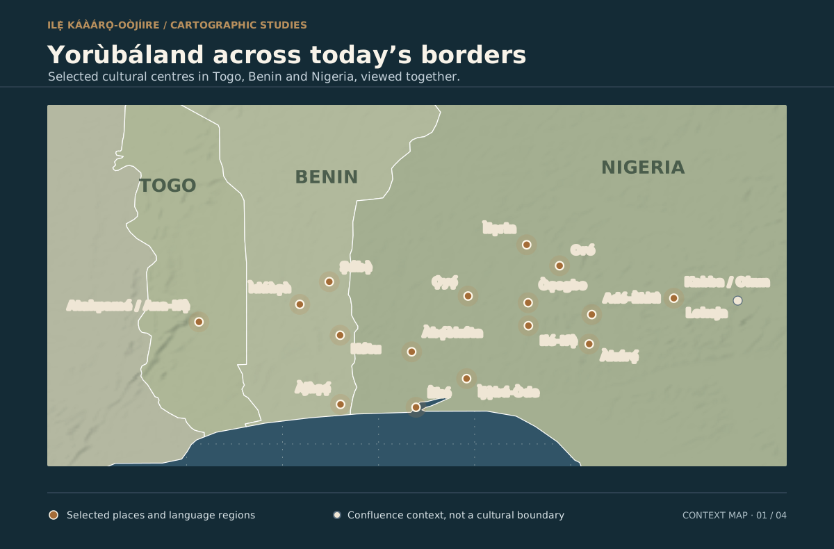
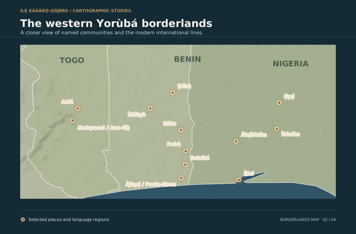
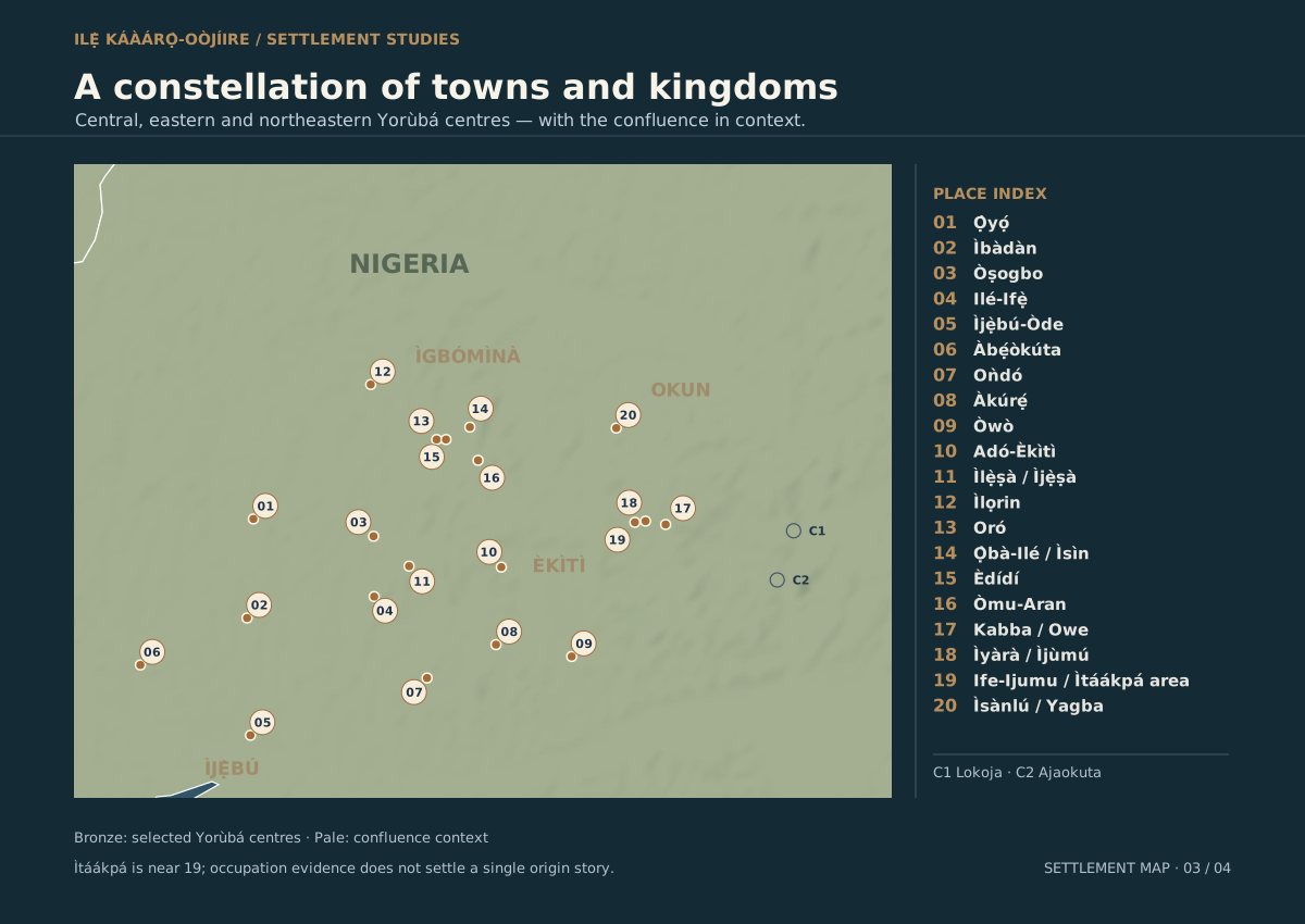
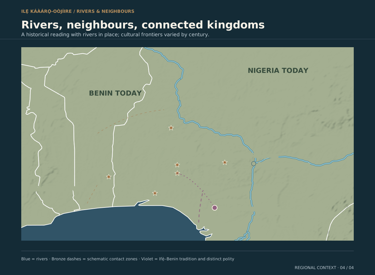
The four existing static map plates also use the shared design and retain their full place indexes. They are self-contained SVGs suitable for editing:
Explore the Yorùbáland atlas → · Explore Ọ̀yọ́ and its neighbours → · Explore development maps →
WIDER AFRICAN CONTEXT
Read relationships at the right scale.
The expanded Ọ̀yọ́ map includes selected late-eighteenth-century states and regional centres, Senegal’s Atlantic shore, the Gulf of Guinea and the whole African continent. The new context points are approximate locators; they do not establish political boundaries. Asante’s existing polygon remains an eighteenth-century expansion summary.
Coastal connections are schematic, not surveyed roads or canoe channels. Refer to Robin Law (1983), James Sanders (1979) and Margaret Priestley (1961). Individual state markers link to their historical sources.
Continental relief: Mapzen Terrain Tiles / NASA SRTM, generalized at zoom 4; projection and method. Rivers: Natural Earth 1:50m public-domain hydrography, used for modern orientation rather than historical channel reconstruction. Reuse terms. Regional political reconstructions keep the licences and attributions listed above.
Download the dated context and source ledger (JSON) · Download the generalized river layer (GeoJSON). Scene exports record the selected layers and map view.