Ọ̀rànyàn, early kingship and Ifẹ̀.
Ajaka, Ṣàngó and Aganju belong to the dynastic and sacred accounts through which Ọ̀yọ́ remembers its early formation. Their significance should not be reduced to a confident-looking date in a modern table.
Context-aware translation drafts. Original English remains available.
Russian celebrates Daria and Adémidé’s family heritage; Igbo celebrates Lékan’s maternal roots.
Translation notes & sourcesSuggest a correction ↗Ọ̀YỌ́ / EMPIRE, MEMORY & RENEWAL
A capital of earth and ambition. A civilization carried through institutions, language and lives. An inheritance that asks what we will build next.
For me, Ọ̀yọ́-Ilé is personal: an ancestral royal connection, a source of pride and a reminder that belonging carries responsibility. Its history gives depth to my sense of purpose and place in the world.
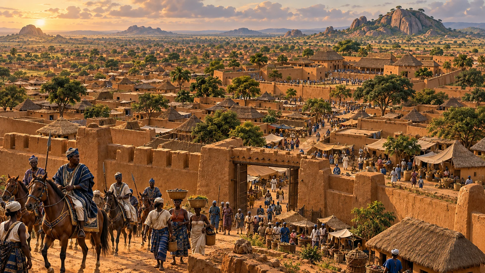
01 / FROM ORIGIN TO EMPIRE
Foundation traditions associate Ọ̀yọ́ with Ọ̀rànyàn / Oranmiyan and Ilé-Ifẹ̀. They establish a remembered relationship between dynasties and sacred authority; they do not give us an independently verified founding year. Early king-lists, oral traditions and archaeological sequences must be read together, with their disagreements left visible.
The imperial period is commonly framed as approximately 1600–1836: more than two centuries in which Ọ̀yọ́ became a major West African power, especially during the eighteenth century. It was one of the largest expressions of Yorùbá political organization, though neither its authority nor its borders ever equalled the whole Yorùbá world. Historical reading and chronology ↗
Ajaka, Ṣàngó and Aganju belong to the dynastic and sacred accounts through which Ọ̀yọ́ remembers its early formation. Their significance should not be reduced to a confident-looking date in a modern table.
Nupe pressure drove the dynasty from Ọ̀yọ́-Ilé. The court passed through exile and established itself at Ìgbòho before returning under Abipa. Robert Smith tentatively placed abandonment around 1535, Ìgbòho’s foundation around 1555 and return around 1610; other chronologies differ. His study associates this period with military and institutional adaptation. Smith’s study ↗
Cavalry, provincial relationships and access to commercial corridors supported expansion. Authority varied: the capital’s core, subordinate towns, colonies and tribute-paying neighbours had different relationships with the Aláàfin. Dahomey was a powerful kingdom compelled to pay tribute, not simply another Yorùbá town. Law on expansion and power ↗
Conflict within the political centre, provincial defiance and the rise of Ìlọrin weakened an already divided empire. The capital’s final abandonment is placed in the mid-to-late 1830s; UNESCO’s nomination summary uses about 1837. Read the causes together ↗
Atiba re-established the royal centre farther south at the present Ọ̀yọ́. The dynasty endured through a changed political world, British colonial rule and modern Nigeria. The survival of kingship should be distinguished from the survival of the old empire’s sovereignty.
02 / THE CITY WAS AN ACHIEVEMENT
A city is more than a throne. Its achievement includes the people who build walls, manage water, grow food, make cloth and ironwork, run markets, maintain households, teach children and transmit knowledge. Ọ̀yọ́’s grandeur becomes more intelligible when we look for those systems alongside its royal ceremonies.
UNESCO’s Tentative List entry describes palace remains, a reservoir, gateways, wells, cisterns and grinding hollows. These are archaeological features, not a surviving palace skyline. The figures describe different enclosures and must not be added together as a city-area total. Read the nomination record ↗
Earthen construction requires knowledge of soil, foundations, drainage and maintenance. A geoarchaeological study of the palace wall identified deliberately incorporated potsherds and a lateritic foundation: material choices worth studying on their own terms. City-wall research, 2023 ↗
Ogundiran’s work approaches the empire through its capital, provinces, colonies and households. That perspective makes room for farming, dependency and domestic life alongside military conquest. Ogundiran’s research overview ↗
For today’s reader, this changes the question: which combinations of skilled labour, reliable infrastructure, local knowledge and organized exchange made such a city possible? A future heritage centre could make those achievements visible through objects, demonstrations and evidence-based digital interpretation.
AN IMPERIAL LANDSCAPE / CIRCA 1780
Trace Ọ̀yọ́ alongside independent Benin, tributary Dahomey, neighbouring Yorùbá kingdoms and Asante farther west. Gold shows the Ọ̀yọ́ Empire around 1780. Terracotta marks Dahomey’s own territory: its kings governed locally while paying tribute to Ọ̀yọ́. Independent Benin and Asante are labelled separately. Begin with West Africa from the Senegal coast to the Gulf of Guinea, or choose the whole continent. Coastal close-ups connect Ọ̀yọ́, Èkó, Ìjẹ̀bú, Dahomey and Kumasi to their wider setting. Trade access and political control are different relationships. Each colour has a different historical meaning; select an area to read it.
Pale gold with a dashed edge marks varying western relationships, not territory uniformly ruled by Dahomey. Dashed cultural-region outlines do not indicate a single government. “Outside Ọ̀yọ́” is not a claim of independence from every neighbouring power.
Circa 1780 footprint. Zoom for more labels; select any coloured area or place for context.
Explore selected African states and coastal connections in their eighteenth-century setting.
Solid outlines distinguish reconstructed kingdoms and regional groupings; they are approximate, not surveyed frontiers. Dashed outlines identify schematic cultural regions, not unified states. Asante’s layer summarizes eighteenth-century expansion, rather than claiming every border was simultaneous with Ọ̀yọ́ in 1780. Campaign pins identify a town or region, not an exact battlefield. Modern borders are shown only for orientation. Later events do not change the circa 1780 footprint.
The outlines adapt Henry B. Lovejoy’s map of the empire at its greatest extent, c.1780, associated with his study in Canadian Journal of African Studies 47(3), p.445. We have simplified and approximately aligned the outlines to modern geography; they cannot establish exact control at a particular village. The source and adapted geometry are shared under CC BY-SA 4.0.
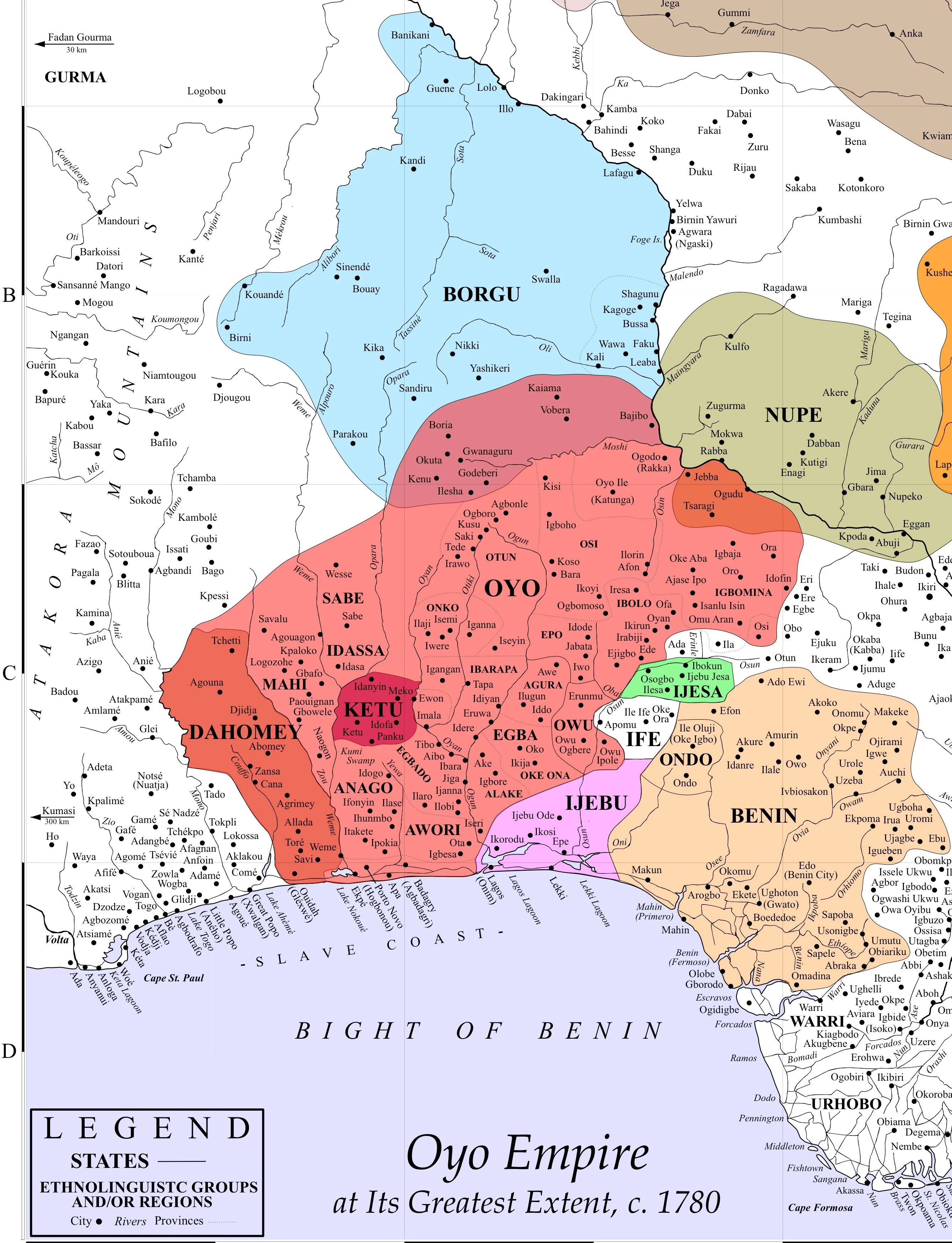
Expansion layer: Allada, 1698; campaigns against Dahomey, 1726–1730, 1742 and 1748. See Toby Green’s African Kingdoms, pp.28–29. Later collapse: Ìlọrin, 1817 and approximately 1823; abandonment of Ọ̀yọ́-Ilé, approximately 1835–1837. See Robin Law’s study of political disintegration and the chapter’s historical reading. Dates and interpretations differ across accounts.
Ilé-Ifẹ̀, Ìjẹ̀bú and Èkó (Lagos) have distinct royal histories; their colours do not place them under the Aláàfin. Benin is an independent kingdom centred on Benin City in present-day Nigeria, not the modern Republic of Benin. The Benin outline covers the portion of the kingdom shown by the regional source, not its maximum extent in every century. Present-day Oró locates the family connection; its pin does not date the settlement to 1780. Rivers and national outlines use Natural Earth; settlement locations follow the atlas’s GeoNames records.
Asante’s approximate expansion envelope follows Ghana: A Country Study, figure 2, printed p.10, drawing on Forde, Kaberry and Ivor Wilks. It represents a different imperial system, centred on Kumasi. Accra, Aného, Atakpamé, Ouidah, Abomey and Kétu help locate the places between the two empires; no continuous imperial corridor between them is implied.
The Pitt Rivers Museum’s Benin introduction explains its independent royal and trading history. For communities on both sides of the lower Niger, see Axel Harneit-Sievers, Constructions of Belonging. Neither the river nor the shaded Igbo context is a fixed ethnic perimeter.
The map separates old Ẹ̀gbá centres, the Ẹ̀gbádò commercial corridor and Àwórì communities. These are regional groupings within a changing imperial network, not modern administrative provinces. Abẹ́òkúta’s emergence around 1830 belongs to a later chapter. Èkìtì’s several kingdoms and the royal centres of Àkúrẹ́, Òwò and Ìdànrè must likewise be distinguished from today’s state boundaries.
Read S. Adebanji Akintoye’s A History of the Yoruba People and Akinwumi Ogundiran’s The Yorùbá: A New History for the wider history. These works provide context; the approximate polygons are this site’s teaching adaptations, not boundaries supplied by those books.
A selected late-eighteenth-century comparison, not a complete political atlas. A regional locator does not imply that a whole modern country belonged to one state. The older Songhai layer in the separate Northern connections map belongs to an earlier period.
Selected city and regional locators. Rounded coordinates orient the reader; they are not historical capitals in every case, surveyed boundaries, or an exhaustive inventory. Existing dated territorial reconstructions retain their separate source limits.
West Africa · Regional locator · middle Senegal valley
Almamate established in 1776; an agricultural and Islamic political centre along the Senegal River. Source ↗
West Africa · Timbo · approximate town locator
A confederated Islamic state from the eighteenth century, with Timbo as its capital. Source ↗
West Africa · Ségou · approximate town locator
The Bamana kingdom at Ségou was established in the early eighteenth century. Source ↗
West Africa · Ngazargamu · approximate site locator
A separate state around Lake Chad; Ngazargamu was its royal centre in the eighteenth century. Source ↗
West Africa · Regional locator · central Gold Coast
Coastal states and trading intermediaries with their own alliances. Coastal trade with Asante did not mean uniform Asante rule. Source ↗
North Africa · Regional locator · Meknes area
An independent monarchy beyond Ottoman rule; the Alaouite dynasty had ruled since the seventeenth century. Source ↗
North Africa · Algiers · city locator
Ottoman affiliation coexisted with substantial autonomy under local military leadership. Source ↗
North Africa · Tunis · city locator
One of the North African Ottoman regencies, with considerable local autonomy by the eighteenth century. Source ↗
North Africa · Tripoli · city locator
Ottoman affiliation did not imply direct administration of every local decision from Istanbul. Source ↗
North Africa · Cairo · city locator
Egypt remained within the Ottoman imperial framework in this period. The marker locates Cairo, not a territorial extent. Source ↗
Central Africa · Regional locator · Kasai
A kingdom formed in the seventeenth century, with distinctive royal art and institutions. Source ↗
Central Africa · Regional locator · Lunda heartland
A long-established state with expanding networks of tribute and exchange, including links toward the Copperbelt. Source ↗
Central Africa · Regional locator · upper Congo basin
A kingdom established before the eighteenth century; courtly arts and political traditions travelled widely. Source ↗
Central Africa · Regional locator · Luapula region
A state established through Lunda expansion in the mid-eighteenth century. Source ↗
Eastern Africa · Gondar · city locator
Gondar was a centre of royal, religious and artistic life. A city marker does not imply uniform control of the surrounding region. Source ↗
Eastern Africa · Harar · city locator
An Islamic state and centre of learning; eighteenth-century caravan networks connected it to surrounding regions. Source ↗
Eastern Africa · Regional locator · Great Lakes
An agricultural kingdom with trading connections across the Great Lakes region. This is not a modern national boundary. Source ↗
Eastern Africa · Mombasa · city locator
An important eighteenth-century coastal state under the Omani-derived Mazrui dynasty, within the diverse Swahili trading world. Source ↗
Southern Africa & Madagascar · Regional locator · western Madagascar
One of the western and southern Malagasy states associated with the Maroserana dynasty. Source ↗
Southern Africa & Madagascar · Regional locator · central Madagascar
Highland polities distinct from the Maroserana states. This point does not project later island-wide expansion backwards. Source ↗
Southern Africa & Madagascar · Cape Town · city locator
A Dutch East India Company settlement established in 1652; shown as a colonial presence, not an indigenous African kingdom. Source ↗
These exchanges included cloth and other goods, and the coercion and violence of the trade in enslaved people. A trading connection is not a claim of political ownership or a precise route.
Saint-Louis. Senegal River outlet; a European trading settlement established in the seventeenth century. Source ↗
Gorée. Atlantic island trading post associated with the history of the slave trade. Source ↗
Anomabu. Fante coastal trading centre. Trade connections with the interior are not a claim of Asante sovereignty. Source ↗
Cape Coast. Coastal trading centre in eighteenth-century relations between African polities and European merchants. Source ↗
Accra. A coastal outlet discussed in eighteenth-century Asante trade diplomacy. Source ↗
Ouidah. Dahomey’s Atlantic-facing trading town; lagoon and inland connections shaped access to the coast. Source ↗
Porto-Novo. A lagoon trading centre connected to the politics of Ọ̀yọ́, Dahomey and neighbouring ports. Source ↗
Badagry. A lagoon port in the contested coastal trading network west of Èkó (Lagos). Source ↗
Èkó (Lagos). An Atlantic port from the 1760s, connected to lagoon traffic and Ìjẹ̀bú cloth production. Source ↗
BEYOND Ọ̀YỌ́ / NORTHERN HORIZONS
See Ọ̀yọ́’s boundaries in their wider West African setting, then look north to distinct political worlds. Explore the Hausa states and their neighbours, Bornu around Lake Chad, or the cities of imperial Songhai. These views cover different periods: The Former Songhai Empire layer represents an earlier, fifteenth- and sixteenth-century heartland and must not be read as contemporary with Ọ̀yọ́’s circa-1780 reach.
Start with the big picture. Check or uncheck options to reveal more places, regions and relationships—and see what changes.
Explore the traditional seven Hausa Bakwai and associated regions.
Bold names identify major empires and regions; individual states and towns use smaller type. The Hausa outline groups the seven Hausa Bakwai geographically, not as one unified empire. Solid outlines mark approximate historical regions; dashed outlines mark associated regions or a schematic heartland. These are teaching maps, not surveyed frontiers or fixed ethnic boundaries. Select a region to see its method and source.
Daura, Kano, Katsina, Zazzau (Zaria), Gobir, Rano and Biram form the traditional Hausa Bakwai. The map also locates Kebbi, Zamfara, Yauri, Gwari/Gbagyi regions, Nupe and Kwararafa. One associated-state tradition includes “Yoruba”; Ọ̀yọ́ is shown as a reference point for that category, not as a Hausa state. Other versions name different places. Neither tradition is a complete census of every polity in Hausaland, and it does not determine people’s ethnic identity.
The regional zones are generalized from Abubakar Sani Sule’s 2013 archaeological thesis, figure 3, after Dierk Lange (2004). Their mixed political and cultural geography is not assigned a single date. For a critical treatment of the traditional classification, see J. E. G. Sutton, “Towards a Less Orthodox History of Hausaland”.
Bornu is shown around 1750, with Ngazargamu and Lake Chad clearly identified. The approximate locator adapts ArnoldPlaton’s map, after Interchange88, under CC BY-SA 3.0; the outline has been simplified and approximately repositioned. It is illustrative, not an independently verified territorial survey. For the region’s fortified capitals and political history, see the historical study of defensive systems south of Lake Chad. Earlier Kanem, later Bornu and their changing dependencies should not be compressed into one timeless boundary.
Gao, Timbuktu and Djenné anchor this earlier imperial world. Kukiya, Walata, Taghaza and Agadez locate origins or wider commercial and political connections. The shaded area is a deliberately schematic Niger heartland, not a claim to Songhai’s maximum reach. Published reconstructions differ, especially when they turn campaigns, trading links or tribute into continuous territory.
See Mark Cartwright’s historical overview and OpenStax’s discussion and primary-source excerpts. The imperial crisis of 1591 belongs to a much earlier moment than Ọ̀yọ́’s eighteenth-century prominence. “Songhai states” should therefore be read with chronology: imperial centres, dependent communities and later successor polities were not all the same political arrangement.
Return to Ọ̀yọ́ and its neighbours · Explore the Yorùbáland atlas
03 / POWER HAD A GEOGRAPHY
Use the first map to move between capitals, imperial connections and the collapse. The second brings Oró, Ìgbómìnà and Odò Ọya into view. Pins locate places; they do not draw a fixed imperial or ethnic perimeter.
Select a place for context and its source. Modern borders are optional orientation.
Ọ̀yọ́-Ilé · old capital — Approximate centre of the UNESCO coordinate range. The archaeological capital is distinct from modern Ọ̀yọ́; this pin is not a visitor entrance. Location source ↗
Ìgbòho — The royal centre during exile. Smith’s study examines the dynasty’s regrouping before the return to Ọ̀yọ́-Ilé. Modern town coordinate. Location source ↗
Ọ̀yọ́-Atiba · present royal centre — The new royal centre after the old capital’s collapse; a living succession in a transformed political setting. Location source ↗
Ilé-Ifẹ̀ — Dynastic traditions connect Ọ̀rànyàn with Ifẹ̀. A place of origin and sacred kingship, not a claim that all Ifẹ̀ history is a province of Ọ̀yọ́. Location source ↗
Abomey · Dahomey — Capital of Dahomey, a distinct kingdom that paid tribute to Ọ̀yọ́ during part of the imperial era. A tributary relationship is not identical to direct rule. Location source ↗
Kétu — An important western Yorùbá kingdom in the wider regional network. Relationships changed; the marker does not imply uninterrupted direct government from Ọ̀yọ́. Location source ↗
Ìlọrin — A centre of Afonja’s rebellion, then an emirate aligned with Sokoto. Its history involves changing alliances and several communities. Location source ↗
Oró — Oró’s palace tradition connects Òlákànmí with Ọ̀yọ́. The family chapter explains the royal affinity and its evidence. Location source ↗
Ìlá Òràngún — An Ìgbómìnà royal centre. Read the region’s local histories alongside evidence of changing relationships with Ọ̀yọ́. Location source ↗
Offa — An Ìbọ̀lọ̀ centre, shown as a northern Yorùbá neighbour of Ìgbómìnà rather than relabelled as the same community. Location source ↗
Jebba · Odò Ọya crossing — A river crossing with layered Yorùbá, Nupe and other histories; orientation towards the Niger, not a fixed imperial frontier. Location source ↗
Èkó (Lagos) — Atlantic and contemporary context. Its Awori, Benin and wider histories should not be collapsed into a claim of direct Ọ̀yọ́ rule. Location source ↗
Modern settlement coordinates come from the existing atlas’s GeoNames references; they are orientation points, not excavated historical town boundaries. Ọ̀yọ́-Ilé uses the centre of the coordinate range in the UNESCO entry. Natural Earth supplies the background rivers and present borders. Relationships follow the historical works cited here; the separate territorial map above explains its source and approximate outlines. The territorial map above distinguishes present-day Ìkọ̀yí-Ilé from the approximate old Ìkọ̀yí position in the historical source; neither marker identifies a surveyed battlefield.
Odò Ọya (River Niger) provides regional context. Oró lies east/southeast of Ọ̀yọ́-Ilé, within northern Yorùbáland and south of the Niger. The river is not drawn as a simple boundary of identity or imperial control. Continue into the full interactive atlas ↗
04 / ALÁÀFIN, COUNCIL & COMMUNITY
Aláàfin, commonly rendered “owner of the palace,” is the royal title of Ọ̀yọ́. The Oòni is the monarch of Ilé-Ifẹ̀: a different institution within the shared Yorùbá world. Keeping the titles distinct honours both histories.
Kingship joined dynastic legitimacy, ritual authority and government. Palace officials and messengers helped connect the ruler to a wider realm. Royal status came with obligations, even where enforcing them became a struggle.
The council of leading chiefs, headed by the Baṣọ̀run, could constrain a ruler. This was an historically specific balance of offices, not a modern parliamentary democracy. Rivalry could turn a check on royal excess into another concentration of power.
Local rulers, military leaders, lineages and productive communities had their own interests. An empire depended on relationships that could be negotiated, exploited or broken. The palace was influential, but it was never the whole society.
Read Samuel Johnson’s account of government alongside Robin Law’s warning about projecting later institutions unchanged into earlier centuries. Johnson, government chapters ↗ · Law, political disintegration ↗
05 / HORSES, Ẹ̀ṢỌ́ & MARTIAL KNOWLEDGE
Ọ̀yọ́’s cavalry was a decisive military asset in open country. Horses connected the kingdom to northern supply networks; maintaining them required resources, knowledge and continuing access. Terrain and disease constrained their usefulness, and mounted power depended on infantry and the wider work of provisioning. Robin Law’s cavalry study ↗
Ìkọ̀yí and the Oníkòyí occupy a distinguished place in Ọ̀yọ́’s martial memory. Johnson describes the Ẹ̀ṣọ́ as a military rank earned by proven ability and records seventy titled captains. That is a description of offices, not a reliable headcount of every mounted soldier in every period.
The title is associated with senior military command; Johnson attributes its introduction to Ajagbo. Its holders operated within a changing relationship between ruler, provincial power and armed force. Afonja’s later rupture with the Aláàfin demonstrates the danger when a commander’s strength outgrows political cooperation.
Martial praise remembers courage, endurance and refusal of disgrace. Today those qualities can inspire service, principled leadership and protection of others. They should be joined to restraint: courage also means refusing a destructive order and finding a way to preserve life.
The horseman is the visible figure. Behind him stand animal care, training, food production, metalwork, leatherwork, reconnaissance and communication. This is a useful way to think about present-day institutions: visible success depends on many forms of less visible competence.
Remembering the Ẹ̀ṣọ́ can encourage excellence without making warfare a model for everyday disagreement. The constructive inheritance is preparedness, courage under pressure and responsibility to a community. Read it beside Ọmọlúàbí and character, where bravery is accountable to humane conduct.
Military offices and the seventy Ẹ̀ṣọ́: Johnson, pp. 73–75 ↗. This late account preserves traditions; the structure must not be assumed identical across the empire’s entire history.
06 / ACHIEVEMENT AND ACCOUNTABILITY
Ọ̀yọ́ participated substantially in enslavement and the Atlantic slave trade. Captivity and the sale of human beings were entangled with warfare, revenue and regional relationships. Those harmed were people with homes, families and futures. Calling this only an unfortunate episode would understate its place in the imperial economy and the suffering it caused.
The empire’s collapse nevertheless cannot be explained by one cause. Political rivalry and provincial rebellion preceded the final military defeats; Ìlọrin’s changing alliances and incorporation into the Sokoto sphere intensified the crisis. Trading dependencies and struggles over resources interacted with these divisions. Law’s analysis of disintegration ↗
Institutions must be able to correct leadership without making every disagreement a struggle for survival.
An economy should reward knowledge, useful goods and human flourishing. Systems that treat people as expendable undermine the society they claim to enrich.
Shared language and history do not automatically settle disputes. Durable cooperation needs fair terms, trusted mediation and room for local autonomy.
A story of a lost capital must include people who fled, rebuilt households or endured enslavement. Their descendants’ histories belong beside the histories of rulers.
These are present-day reflections drawn from the history, not a claim that a single policy would have prevented its collapse. A confident identity can celebrate accomplishment while refusing to repeat its injustices.
07 / THE ROYAL SUCCESSION
The succession below brings together the commonly published names from Ọ̀rànyàn to Abimbola Akeem Owoade I, whose appointment and 2025 coronation are recorded by Oyo State institutions. Early names, spellings, order and reign dates differ across sources; this is a traditional and historical list, not a complete independently verified chronology.
Official appointment record ↗ · Official coronation record ↗
Ajàká’s return is shown as a second tenure. Ìyáyún and Adásóbo are separately acknowledged as regents in some traditions. Counting regencies and repeat reigns differently changes the numbering; “46th Aláàfin” is the current official designation, not a reason to invent missing kings or precise early dates. Dates for early reigns are deliberately left open.
| Aláàfin / tenure | Period or dating note |
|---|---|
| Ọ̀rànyàn / Oranmiyan | Early tradition · dates uncertain |
| Ajàká — first tenure | Early tradition · dates uncertain |
| Ṣàngó / Shango | Early tradition · dates uncertain |
| Ajàká — restored | Early tradition · dates uncertain |
| Aganju / Aganjusola | Early tradition · dates uncertain |
| Kori | Early tradition · dates uncertain |
| Oluaso | Early tradition · dates uncertain |
| Onigbogi | Early tradition · dates uncertain |
| Ofiran | Exile, Ìgbòho and return · dates debated |
| Egunoju / Eguguojo | Exile, Ìgbòho and return · dates debated |
| Orompoto | Exile, Ìgbòho and return · dates debated |
| Ajiboyede | Exile, Ìgbòho and return · dates debated |
| Abipa | Exile, Ìgbòho and return · dates debated |
| Obalokun | Early imperial period · dates uncertain |
| Oluodo | Early imperial period · dates uncertain |
| Ajagbo | Early imperial period · dates uncertain |
| Odarawu | Early imperial period · dates uncertain |
| Kanran | Early imperial period · dates uncertain |
| Jayin | Early imperial period · dates uncertain |
| Ayibi | Early imperial period · dates uncertain |
| Osinyago / Osiyago | Early imperial period · dates uncertain |
| Ojigi | Eighteenth century · reign dates debated |
| Gberu | Eighteenth century · reign dates debated |
| Amuniwaiye | Eighteenth century · reign dates debated |
| Onisile | Eighteenth century · reign dates debated |
| Labisi | Eighteenth century · reign dates debated |
| Awonbioju | Eighteenth century · reign dates debated |
| Agboluaje | Eighteenth century · reign dates debated |
| Majeogbe | Eighteenth century · reign dates debated |
| Abiodun | Eighteenth century · reign dates debated |
| Awole Arogangan | c.1789–1796 |
| Adebo | c.1796–1797 |
| Makua | c.1797 |
| Majotu | c.1802–1831 |
| Amodo | c.1831–1833 |
| Oluewu | c.1833–1835/36 |
| Atiba Atobatele | c.1837–1859 · new capital |
| Adelu Agunloye | 1859–1875 |
| Adeyemi I Alowolodu | 1876–1905 |
| Lawani Amubieya Agogoja | 1905–1911 |
| Siyanbola Onikepe Oladigbolu I | 1911–1944 |
| Adeyemi II Adeniran | 1945–1955 |
| Bello Gbadegesin Oladigbolu II | 1956–1968 |
| The late Lamidi Olayiwola Adeyemi III | 1970–2022 · died 22 April 2022 |
| Abimbola Akeem Owoade I | 2025–present · record checked 7 October 2026 |
The names and later dates are cross-checked against the published comparative list, which identifies disagreements and its sources. Consult Johnson, Law’s study of how traditions were recorded, and the historical books below before treating any reconstructed early chronology as settled. Gaps between later reigns include vacancies; they are not assigned invented occupants.
08 / ORÓ, ÌGBÓMÌNÀ & A FAMILY THREAD
Oró and Ọ̀yọ́ share an affinity carried in royal traditions, family relationships and cultural memory. Ìgbómìnà formed part of the wider imperial world on its eastern and northeastern side, with different local experiences of Ọ̀yọ́ authority. Archaeological work follows these relationships through settlement change, ceramics and fortifications. The region also had histories and institutions of its own. Usman on the northern provinces ↗ · Frontier settlements and walls ↗
In our family’s palace tradition, Ọmọọba Òlákànmí of Ọ̀yọ́ connects the Baálẹ̀ royal house of Oró to this older world. My paternal grandmother, Ọmọọba Moróláké Agnes, was the daughter of Baálẹ̀ Atóyèbí. Through her, I carry that royal strand alongside Ilé Olúkòtún’s Ọ̀bà-Ilé inheritance. The family page sets out the testimony, genealogy and limits of the surviving public references. Follow the royal family account ↗
This connection is something I hold with deep pride. It gives history an intimate scale: names, homes, duties and people who knew one another. For me, its value lies in what it asks me to preserve, learn and contribute.
My father, Chief Olatunji Raphael Ibiwoye, recalled the late, beloved Aláàfin Lamidi Olayiwola Adeyemi III (reigned 1970–2022) as his classmate at St Gregory’s College and a friend into adulthood. Our family archive records the Aláàfin opening our house, Ilé Olúkòtún in Oró, in 1987, and my father visiting him at the Ọ̀yọ́ palace in 2020. These are family identifications and recollections, preserved with the photographs.
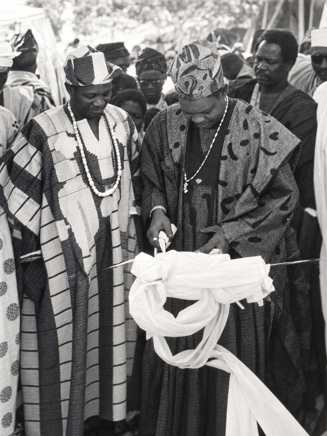
AI-assisted restoration for viewing; fine detail may be reconstructed. The untouched photograph remains the historical reference.
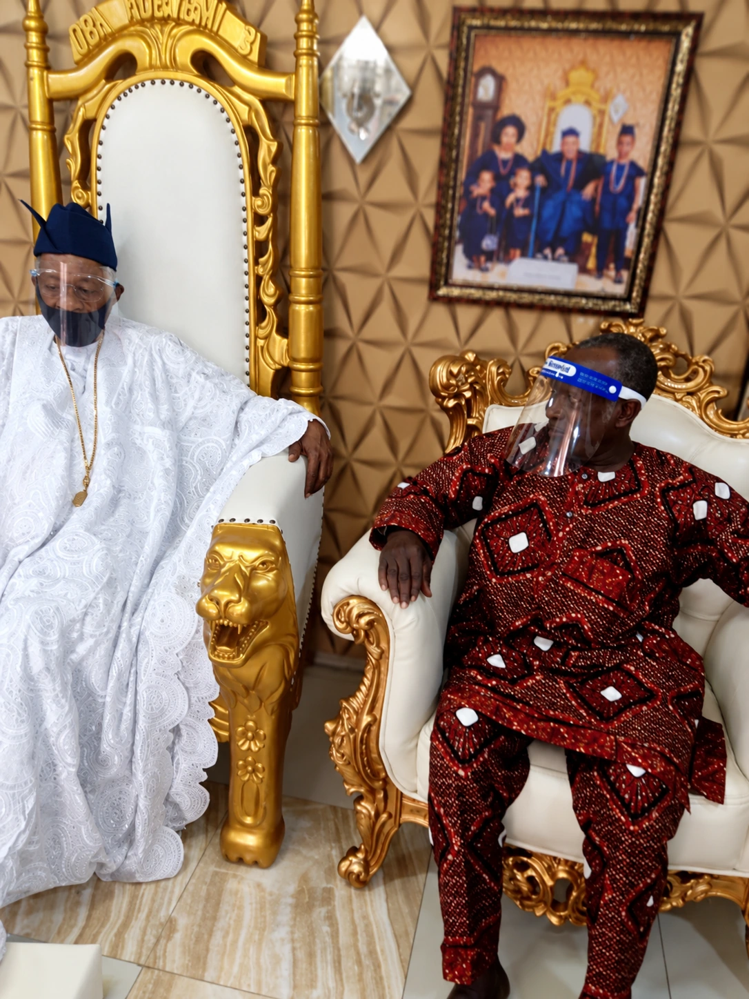
AI-assisted restoration for viewing; fine detail may be reconstructed. The untouched photograph remains the historical reference.
The Òlákànmí chapter explores the Oró royal tradition in a larger account of settlement, negotiation and belonging. It sits alongside the Ọ̀bà-Ilé–Oró migration story. Family memory and historical research meet here without being treated as interchangeable evidence. A royal genealogy does not establish every date in an empire’s chronology; archaeology does not by itself prove a named family’s descent.
09 / THE CAPITAL TODAY
Ọ̀yọ́-Ilé survives as an archaeological landscape within Old Oyo National Park. Its UNESCO Tentative List submission dates to 1995; that status does not mean it is an inscribed World Heritage Site. The Nigeria National Park Service is part of its present institutional setting.
Ọ̀yọ́-Ilé should become a great place of remembrance and an attractive cultural destination: somewhere to encounter African kingship, imperial power, urban culture and the ingenuity of a people. A connected heritage journey could link the ancient capital with the living royal city of Ọ̀yọ́-Atiba, its palace traditions, crafts and communities. That is the future I want this project to help people imagine.
I want this capital to be encountered with the dignity its history deserves: a place where a Yorùbá child—or a visitor arriving from anywhere in the world—can understand the scale of what stood here and feel the possibilities it opens. An overgrown ruin without accessible interpretation cannot carry that task alone.
The presence of wildlife is not the failure. A protected landscape and a great cultural destination can coexist. The challenge is to make the capital’s history legible, care for the evidence, and give surrounding communities a meaningful role in the benefits. New buildings should serve that purpose without burying or replacing the archaeological record.
These are proposals for discussion, not an announced construction project or an assessment based on a recent site inspection.
10 / AN ASCENDING FUTURE
Ọ̀yọ́ offers Yorùbá people everywhere an invitation to study achievement at scale: institutions, infrastructure, specialist knowledge and the coordination of many communities. It also asks us to study failure with equal seriousness. Learning both is a stronger foundation for renewal than nostalgia alone.
The documentary Bigger Than Africa follows Yorùbá culture across the Atlantic to the United States, Brazil and the Caribbean. Its title captures cultural reach beyond a continent. That reach was carried by people, including those who survived enslavement; it should never make their suffering sound like the price of a welcome expansion.
Yorùbá civilization is older than modern Nigeria and extends beyond its borders. My aspiration is that knowing this deepens our confidence to create: better schools, productive enterprise, beautiful and functional towns, institutions worthy of trust, and cultural work that future generations can inherit with pride.
Turn historical curiosity into language learning, research, engineering, design and practical skills. Make excellence teachable.
Build connections across towns and the diaspora, while respecting neighbours and differing histories. Let shared purpose produce useful work.
Put Ọmọlúàbí into leadership, enterprise and care for public goods. Nobility is most persuasive when it serves.
Explore identity, resources and economic possibility ↗ · Return to the Tapestries project ↗
Aláàfin of Ọ̀yọ́
Reign began: 2025. Staff of office: 13 January 2025; coronation: 5 April 2025. Date source ↗
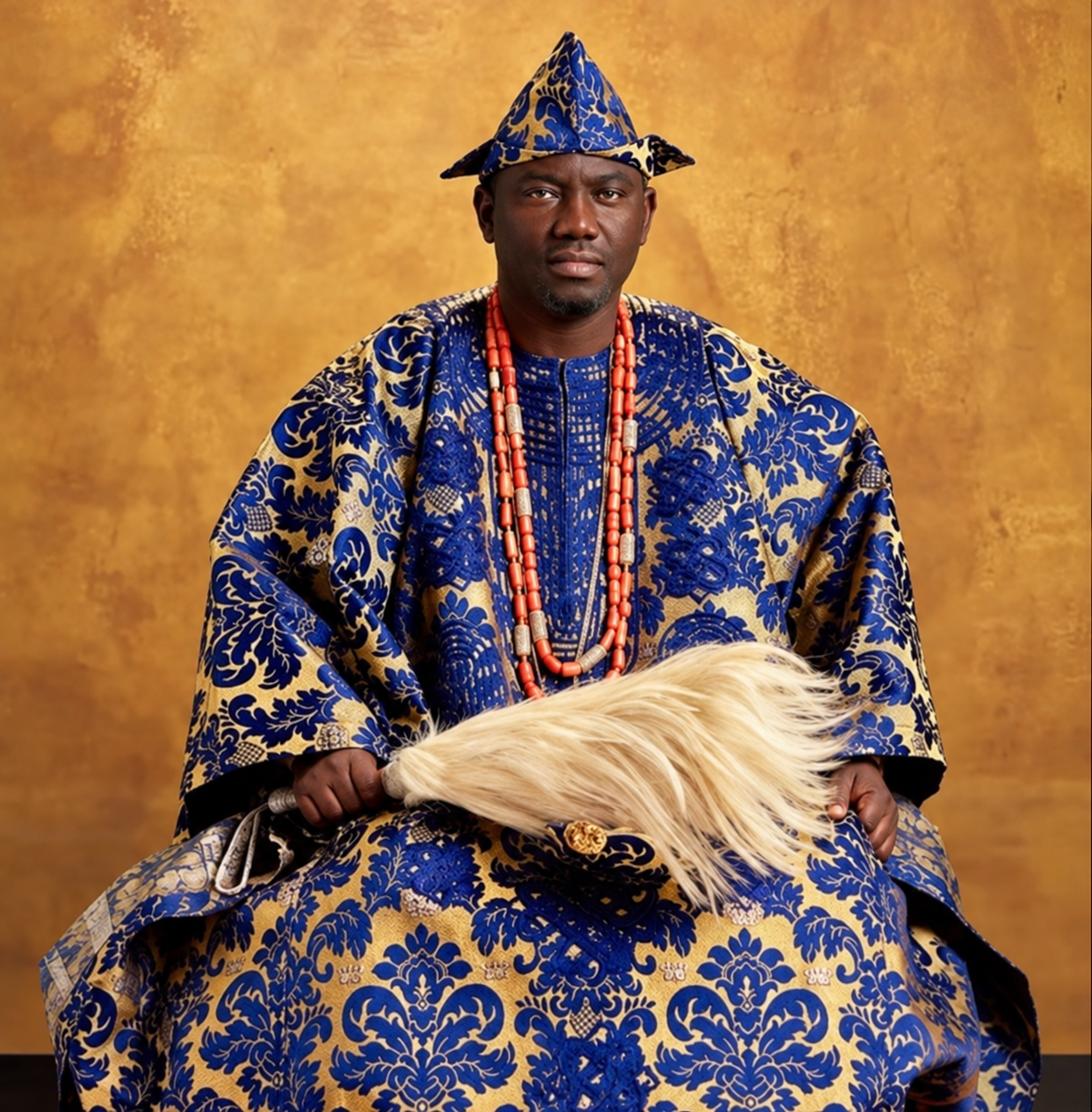
The Aláàfin in woven regalia and coral beads. The office carries Ọ̀yọ́’s inheritance into a different political age. Read further.
READ FURTHER / TRADITION & EVIDENCE
Read these works together. A royal chronicle, a family recollection, an excavation and an institutional record answer different questions.
Prepared 7 October 2026. The family connection follows the owner’s account and existing family archive; the books above are not presented as independent verification of that genealogy. Artistic interpretation is labelled beside the image.
Enable JavaScript to choose optional feedback-based suggestions.
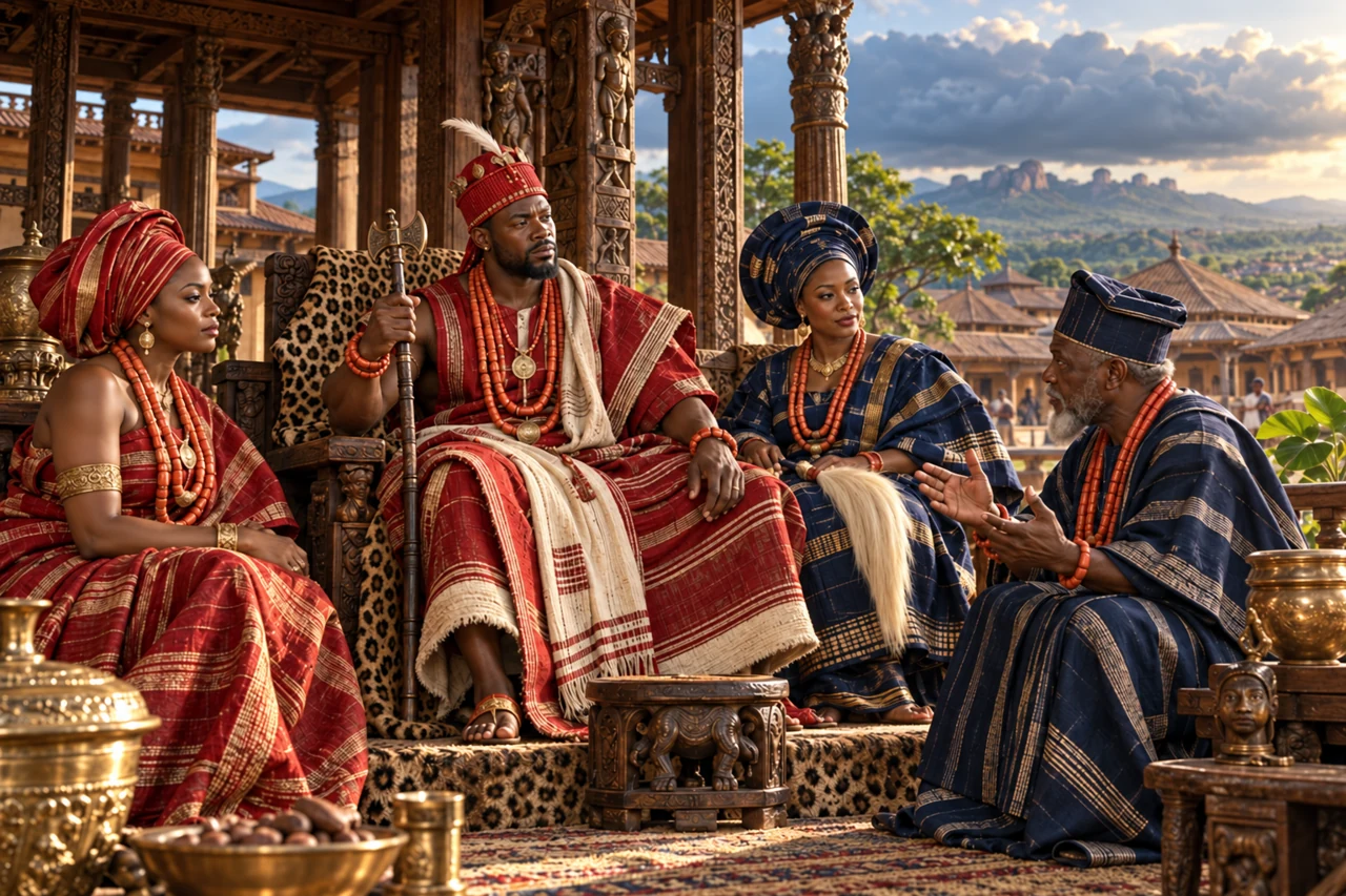
Read the mapped layer, source date and geographic definition together. These visualisations are geographic explanations, not AI predictions or legal boundaries.
Number of concepts in this guide, not performance or usage measures.
7 concepts shown
On small screens, scroll the table sideways. “Learning context” explains a related idea; it does not mean that method runs on this page. Deep learning is the standard term for “deep ML”.
| Technical term | Technical description / definition | In plain English | How this page uses it |
|---|---|---|---|
| Geospatial layers and projectionVisualisation | Coordinates are transformed to a map surface; separate layers encode geographic features or interpretations.Primary reference ↗ | A map combines evidence layers. Its boundary lines need a date and a meaning. | Running here Separate layers show geographic features and interpreted historical or cultural regions. The source and definition control their meaning. |
| Visual encodingVisualisation | Mapping values or categories to marks, position, length, colour and labels.Primary reference ↗ | Make the comparison visible, with a scale and a clear label. | Running here Position, colour, area and labels make comparisons visible; changing the map view does not improve source certainty. |
| Rates and denominatorsAI/Data Concepts | A rate or share relates a count to a defined exposure or eligible population.Primary reference ↗ | Keep the number underneath the fraction visible when comparing people or periods. | Published analysis Area or population comparisons require compatible definitions and reference dates. |
| Extraction, transformation and provenanceData Science Pipeline | ETL moves data from sources through defined transformations; provenance records its origin and changes.Primary reference ↗ | Read it, tidy it, and keep the receipt. | Method guide Prepared geographic assets retain citations and boundaries of interpretation. |
| Probability and uncertaintyAI/Data Concepts | A probability quantifies an event under a model and assumptions; it is not a guarantee.Primary reference ↗ | A chance, not a promise. Ask what evidence and assumptions produced it. | Responsible use Approximate cultural extents and estimates should not be read as precise surveyed borders. |
| Human oversight and consentResponsible AI | People retain appropriate review authority, permission controls and correction routes for data use and outputs.Primary reference ↗ | Keep someone able to question, correct or stop the result. | Responsible use The map supports learning and inquiry, with source notes and correction routes. |
| Machine learning (ML)AI Capability | Methods that estimate patterns or parameters from examples to support inference on other inputs.Primary reference ↗ | Learn a pattern from examples, then check whether it helps with new ones. | Learning context These geographic views do not infer ethnicity, ancestry or future population from a trained ML model. |
No matching concepts. Choose another category or clear the search.

Olukotun Studios Ltd · Registered in England and Wales · No. 17537910
Registered office: 5 Brayford Square, London, E1 0SG, England.

