YORÙBÁLAND / RESOURCES & DEVELOPMENT
The land, with its details intact.
A sourced catalogue of hills, rivers, water bodies, forests and cultural landscapes across the Yorùbá world and its neighbouring regions.
Research review · 20 October 2026 · Each statistic keeps its own reference period.
One connected landscape, many kinds of evidence.
The cultural geography extends beyond Nigeria’s southwest. Benin’s Nago and related Èdè communities and Togo’s Ana-Ifẹ̀ world belong in the conversation. Mixed settlements, neighbouring peoples and modern jurisdictions remain visible.
Relief, soil, catchments and ecology shape productive possibilities. They do not prove that every site is accessible, every soil fertile, or every river suitable for navigation, irrigation or hydroelectricity.
Open the landscape evidence map →
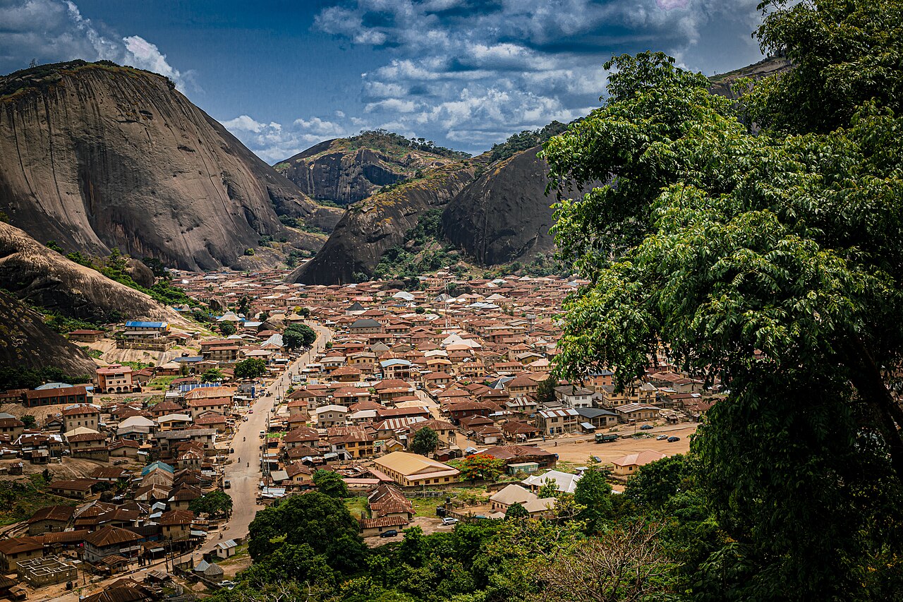
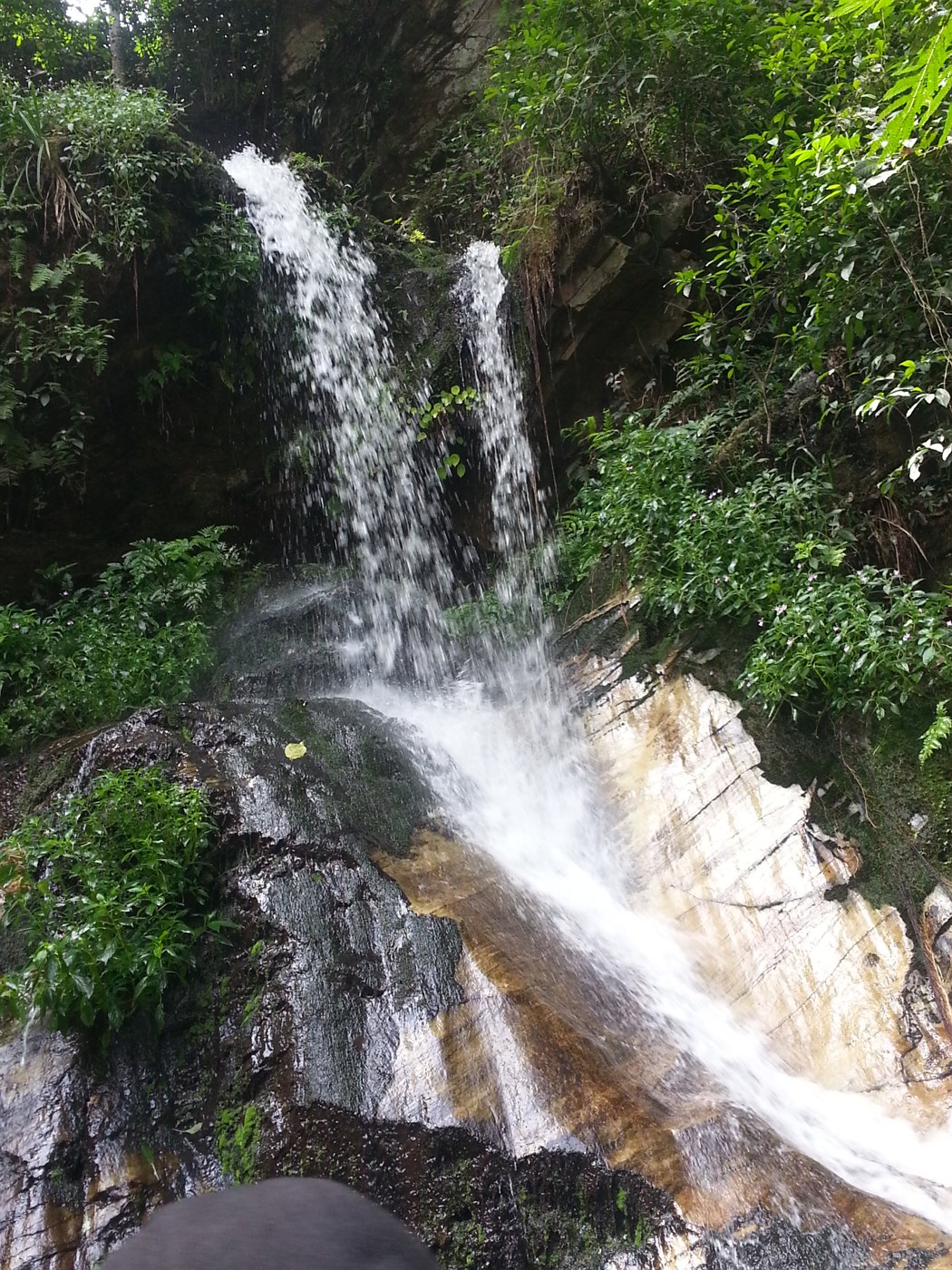
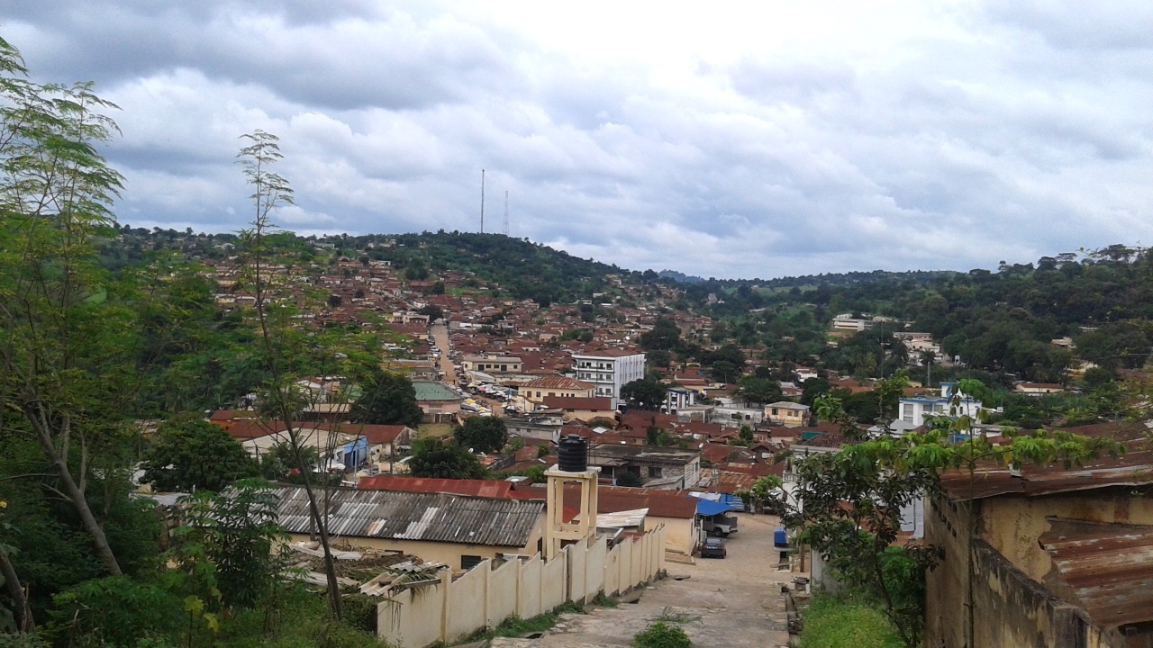
Browse the landscape and water catalogue.
Open an entry for the current finding and source links. “Confirmed” applies to the specific description supported by the linked sources. “Unverified” means the detail has not been established; it does not mean the place cannot exist.
Yorùbáland beyond current national bordersConfirmed
Nigeria / Benin / Togo
Yorùbá-Nago communities span southwest Nigeria, Benin and Togo. Cultural geography is not a legally surveyed national boundary.
UNESCO: Oral heritage of Gelede ↗Plains and rolling hillsConfirmed
Nigeria · Yorùbáland
Rolling plains, valleys and rocky uplands support varied farming and settlement. Suitability must be assessed locally rather than assumed from ethnic geography.
Ekiti Water and Sewerage Company: About Ekiti State ↗Soil fertilityUnverified
Nigeria · Yorùbáland
Regional soil fertility and crop suitability require local soil surveys. Suitability depends on soil type, nutrients, drainage, slope, management and rainfall.
A confirming source for this detail has not yet been established.
Rainforest beltConfirmed
Nigeria · Yorùbáland
Rainforest persists in reserves, sacred groves and other fragments. The region is not uniformly covered by intact dense forest.
UNESCO MAB: Omo Biosphere Reserve ↗ · UNESCO World Heritage: Osun-Osogbo Sacred Grove ↗Omo Forest / Biosphere ReserveConfirmed
Nigeria · Yorùbáland
Omo in Ogun’s Ijebu area supports forest biodiversity and community livelihoods. Distinguish the wider forest reserve from its protected biosphere zones.
UNESCO MAB: Omo Biosphere Reserve ↗Niger RiverConfirmed
Nigeria · Yorùbáland
The Niger belongs in a wider regional water and trade context. The Ogun–Osun coastal basins are separate drainage systems, not Niger tributaries.
Hydroclimatic trends, breakpoints and future projection analysis of the Ogun River Basin ↗Ọ̀ṣun RiverConfirmed
Nigeria · Yorùbáland
The river connects living religious traditions with a coastal drainage basin. UNESCO confirms the sacred river and grove at Osogbo; inland water ultimately links to Lekki Lagoon.
UNESCO World Heritage: Osun-Osogbo Sacred Grove ↗ · Seasonal Variation in Physicochemical Parameters of Lekki Lagoon ↗Ògùn RiverConfirmed
Nigeria · Yorùbáland
A major southwest basin river flowing south to Lagos Lagoon. Published hydrology documents its headwaters and seasonal flow; development must include flooding and water-quality management.
Hydroclimatic trends, breakpoints and future projection analysis of the Ogun River Basin ↗Coast, lagoons and mangrovesConfirmed
Nigeria · Yorùbáland
Coastal lagoons, creeks, wetlands and mangroves support fisheries and transport while facing flood, pollution and development pressures. These are shared ecosystems, not empty industrial land.
Arup / City Water Resilience Approach: Lagos City Characterisation ↗Idanre HillsConfirmed
Nigeria · Yorùbáland
Idanre is an inhabited cultural landscape of rock outcrops, valleys and historic buildings in Ondo. It is on UNESCO’s Tentative List (2007), not the inscribed World Heritage List.
UNESCO Tentative List: Oke Idanre ↗Ekiti uplandsConfirmed
Nigeria · Yorùbáland
Ekiti’s rocky hills and valleys are prominent landscape features. Local elevation can affect temperature, but the uplands remain tropical.
Ekiti Water and Sewerage Company: About Ekiti State ↗Urban and rural economiesConfirmed
Nigeria · Yorùbáland
Lagos, Ibadan and Abeokuta connect trade, services, education and industry with rural production. Avoid portraying all villages as static or uniformly traditional.
Oyo State Government: About Oyo State ↗Oke-Ogun uplands / plateauUnverified
Nigeria · Yorùbáland
Oke-Ogun is a real regional name. A single formally bounded “Oke-Ogun Plateau,” its climate advantage and the precise crop claims need a mapped agricultural or geomorphological source.
Oyo State Government: About Oyo State ↗Ijesha PlateauUnverified
Nigeria · Yorùbáland
Ijesha uplands and mining landscapes require geological mapping to establish the plateau boundary and the extent of mineral occurrences. A place name does not establish a reserve estimate.
A confirming source for this detail has not yet been established.
Osun and Ogun valleysConfirmed
Nigeria · Yorùbáland
River valleys can support cultivation and water supply but are also flood-sensitive. Irrigation access, soil quality and sustainable abstraction must be demonstrated at each site.
Hydroclimatic trends, breakpoints and future projection analysis of the Ogun River Basin ↗Efon / Effon Ridge and escarpmentConfirmed
Nigeria · Yorùbáland
Efon-Alaaye is on the western side of Ekiti adjoining Osun.
Ekiti State Government: Efon local government ↗Olumo RockConfirmed
Nigeria · Yorùbáland
Olumo is the Abeokuta rock sanctuary and visitor site associated with Ẹ̀gbá refuge and history. The tourist complex is a current primary source for site information.
Olumo Rock Tourist Complex ↗Akure Forest ReserveConfirmed
Nigeria · Yorùbáland
Akure Forest Reserve in Ondo State is documented in a 2021 Forestry Research Institute of Nigeria tree-species dataset. Its biodiversity and conservation significance warrant inclusion; the dataset does not establish its present condition or effective protection.
FRIN / GBIF: Checklist of Tree Species in Owena Permanent Sample Plot (PSP 29) of Akure Forest Reserve, Ondo State, Nigeria ↗Ọ̀ṣun-Òṣogbo Sacred GroveConfirmed
Nigeria · Yorùbáland
An inscribed World Heritage property since 2005, combining forest, river, shrines and continuing worship. It is living heritage with conservation and visitor-management responsibilities.
UNESCO World Heritage: Osun-Osogbo Sacred Grove ↗Lekki wetlandsConfirmed
Nigeria · Yorùbáland
Wetlands around the Lekki/Lagos system support water regulation and habitat. Any specific site requires a boundary and assessment; broad ecosystem value does not license reclamation.
Arup / City Water Resilience Approach: Lagos City Characterisation ↗Cocoa beltUnverified
Nigeria · Yorùbáland
Cocoa farming and processing offer a development pathway. Comparative productivity in Ondo and Oyo requires state-level output, year and yield data; no ranking is established here.
A confirming source for this detail has not yet been established.
Oil-palm landscapesUnverified
Nigeria · Yorùbáland
Palm-oil farming and processing offer a development pathway. Local cultivation, processing capacity and environmental conditions require site-specific evidence.
A confirming source for this detail has not yet been established.
Ilé-Ifẹ̀Confirmed
Nigeria · Yorùbáland
Ilé-Ifẹ̀ is central to Yorùbá sacred and artistic traditions, with heritage places and festivals recorded by Osun’s tourism authority. Distinguish tradition, archaeology and modern city life.
Osun State Government: Tourist Centres ↗Erin-Ijesha / Olumirin WaterfallsConfirmed
Nigeria · Yorùbáland
Erin-Ijesa’s Olumirin cascades are a documented Osun visitor landscape. Community and state sources support the location and the seven-level description.
Erin-Ijesa Development Association: Olumirin Waterfalls ↗ · Osun State Government: Tourist Centres ↗Owu WaterfallsConfirmed
Nigeria · Yorùbáland
Owu Falls is in Kwara’s Ifelodun area. State tourism material gives an approximate 120 m figure; a continental height ranking is not established.
Kwara State Government: Tourism ↗Ikogosi warm and cold springsConfirmed
Nigeria · Yorùbáland
Ikogosi in Ekiti contains adjoining warm and cool spring channels in a wooded hill setting. Avoid claiming that mixed water permanently preserves two temperatures or that the site is globally unique.
Ekiti State Facts and Figures 2023, tourism table 9.1 ↗ · Ekiti State Government: Tourism ↗Arinta WaterfallsConfirmed
Nigeria · Yorùbáland
Arinta is at Ipole-Iloro, Ekiti, in the wider Ikogosi tourism corridor. A named location is more useful than treating the falls as part of one undifferentiated resort.
Ekiti State Facts and Figures 2023, tourism table 9.1 ↗Ogbunike CavesConfirmed
Anambra · outside Yorùbáland
Ogbunike Caves are in Anambra, southeast Nigeria. They are included as an external comparison, outside the Yorùbáland location inventory.
UNESCO Tentative List: Ogbunike Caves ↗Sungbo’s EredoConfirmed
Nigeria · Yorùbáland
A major Ijebu earthwork system. Archaeological chronology and construction evidence should be presented separately from traditions about Bilikisu Sungbo; a queen-origin story is not a proved construction attribution.
Chronology, Construction, and Meaning at Sungbo’s Eredo ↗Royal palaces and historical marketplacesConfirmed
Nigeria · Yorùbáland
Palaces, markets and festivals are living civic and cultural institutions. Use individual place histories and custodians rather than giving every market an unverified age or river-crossroads origin.
Osun State Government: Tourist Centres ↗Cocoa HouseConfirmed
Nigeria · Yorùbáland
Cocoa House is an important Ibadan commercial landmark associated with Western Region agricultural wealth and Odu’a Investment. Its 60th anniversary was marked in 2025.
Odu’a Investment: Oyo State Police Command Visits Cocoa House ↗Kainji Lake National ParkConfirmed
Niger / Kwara · wider regional comparator
Kainji comprises Borgu and Zugurma sectors in Niger and Kwara. A Kwara administrative location does not by itself establish Yorùbá cultural territory.
Nigeria Park Service: Kainji Lake National Park ↗Climate gradientConfirmed
Nigeria · Yorùbáland
Describe tropical coastal, forest and savanna transitions with wet and dry seasons. Northern Yorùbáland is not a temperate climatic zone.
Ekiti Water and Sewerage Company: About Ekiti State ↗Badagry coastConfirmed
Nigeria · Yorùbáland
Badagry links coast, creek, trade and histories of enslavement. Heritage interpretation should also acknowledge the locality’s multiple communities rather than assume one exclusive identity.
Arup / City Water Resilience Approach: Lagos City Characterisation ↗Lagos LagoonConfirmed
Nigeria · Yorùbáland
Lagos Lagoon is part of an interconnected urban estuarine system with industry, transport, fishing and significant pollution pressures. Water quality must be measured, not inferred from scenery.
Seasonal and spatial variations of physicochemical parameters and heavy metals in interconnected lagoons ↗Zuma RockConfirmed
Niger State · outside Yorùbáland
Zuma Rock near Abuja/Niger is included as an external inselberg comparison, outside Yorùbáland.
Niger State Government: About Niger State ↗Egbe reservoir and surrounding hillsConfirmed
Nigeria · Yorùbáland
The documented Egbe Water Scheme is at Egbe-Ekiti. Reservoir-hill tourism facilities are not established by this source.
Ekiti Water and Sewerage Company: Egbe Water Scheme ↗Okomu National ParkConfirmed
Edo State · wider regional comparator
Okomu is an Edo forest park. It is a useful wider forest-conservation comparator, not evidence that the park is Yorùbá territory.
Nigeria Park Service brochure ↗Igbeti hills / Iyamopo / AgbeleConfirmed
Nigeria · Yorùbáland
Official Oyo tourism sources name Iyamopo and Agbele at Igbeti. They are not another name for Oke’badan in Ibadan; the asserted Ogbomoso-hills extension is unsupported.
Oyo State Government: About Oyo State ↗Yewa RiverConfirmed
Nigeria · Yorùbáland
Yewa belongs to the western coastal drainage system with cross-border connections. Its exact course requires a hydrographic map.
Arup / City Water Resilience Approach: Lagos City Characterisation ↗Majidun wetlands, river and creekConfirmed
Nigeria · Yorùbáland
Majidun forms part of the Ikorodu/Lagos water network. River, creek and adjacent wetland should be mapped as related features rather than counted as three independent resources.
Arup / City Water Resilience Approach: Lagos City Characterisation ↗Old Oyo National Park and Oyo-IleConfirmed
Nigeria · Yorùbáland
Old Oyo connects protected savanna landscapes with archaeological remains of Oyo-Ile. Conservation and interpretation of the historical city belong together.
Nigeria Park Service brochure ↗Oke-Ila ridgeUnverified
Nigeria · Yorùbáland
Oke-Ila Orangun is a real place; this exact named ridge, its boundary and claimed accessibility remain unverified. Keep the local-name lead pending custodian or survey confirmation.
A confirming source for this detail has not yet been established.
Ado-Awaye / Oke Ado / IyakeConfirmed
Nigeria · Yorùbáland
Ado-Awaye and its upland Iyake lake are recognized Oyo tourism features. Avoid unsupported claims about being the world’s only or one of exactly two “suspended lakes.”
Oyo State Government: About Oyo State ↗Obafemi Awolowo University campus hillsUnverified
Nigeria · Yorùbáland
The campus landscape is a potential subject for study. A named hill range, mapped boundary and visitor access have not been established here.
A confirming source for this detail has not yet been established.
Olosunta and Orole hillsConfirmed
Nigeria · Yorùbáland
Both hills are at Ikere-Ekiti and are listed in Ekiti’s official tourism inventory. Local sacred practices require custodian-led interpretation.
Ekiti State Facts and Figures 2023, tourism table 9.1 ↗Oke-Ero hills near IjeroUnverified
Nigeria · Yorùbáland
Oke-Ero is a Kwara local government, whereas Ijero’s official profile names Oke-Ayinrin and Oke Ede. The intended hill locality remains unverified.
Kwara State Government: Local Government Areas ↗ · Ekiti State Government: Ijero ↗Oke-Maria, Otan AyegbajuConfirmed
Nigeria · Yorùbáland
The Redemptorist-run Marian pilgrimage centre is on the hills of Otan Ayegbaju, Osun. A February 2026 report confirms continuing pilgrimage activity.
Redemptorists: Annual Oke Maria pilgrimage ↗Ogba Hills near Ondo townUnverified
Nigeria · Yorùbáland
No adequate primary identification of this exact hill group near Ondo town was established. Preserve the name as a lead, not a verified biodiversity or hiking destination.
A confirming source for this detail has not yet been established.
Oke-Iho Hills at Ijebu-JesaUnverified
Nigeria · Yorùbáland
An Oke-Iho Hill in the Ijebu-Jesa area remains unverified. Gazetteers place an Oke-Iho Hill in Oyo; repeated local names require precise coordinates.
GeoNames: Oke-Iho Hill (name/coordinate cross-check) ↗Ori-Oke Baba AbiyeConfirmed
Nigeria · Yorùbáland
The prayer institution has its own public contact site. “Ede” is a broad association; establish the precise Alaasān/Egbedore location before placing a map pin.
Ori-Oke Baba Abiye: Contacts ↗Apata HillsUnverified
Nigeria · Yorùbáland
Apata is too general a name to identify a single Ekiti hill group. Location, access and biodiversity require an attributable local source.
A confirming source for this detail has not yet been established.
Iroko Hill near IlesaUnverified
Nigeria · Yorùbáland
The exact hill and its naming history remain unverified. The cultural importance of the ìrókò tree does not establish this place’s etymology.
A confirming source for this detail has not yet been established.
Ikere Gorge / reservoirConfirmed
Nigeria · Yorùbáland
Ikere Gorge is a constructed reservoir near Iseyin in Oyo, not a natural reservoir at Ikere-Ekiti. Designed hydropower capacity is distinct from demonstrated electricity generation.
Species composition, abundance and diversity of fishes in Ikere Gorge ↗“Rock of Gibraltar of Yorubaland”Unverified
Nigeria · Yorùbáland
This nickname has no verified Osun site or mapped location in the available sources.
A confirming source for this detail has not yet been established.
Ayetoro HillUnverified
Nigeria · Yorùbáland
Ayetoro is a repeated place name. If the intended place is Ilaje’s coastal Aiyetoro, the community documents a low-lying coast and erosion, not this asserted hiking hill.
Ayetoro Digital Museum: Visit and community landscape ↗Oke-Agbe hillsConfirmed
Nigeria · Yorùbáland
Oke-Agbe is in Akoko, Ondo, with a studied geological and road corridor. The generic visitor-access and ecological-balance claims are not a substitute for a site survey.
Geotechnical investigation along Arigidi/Oke-Agbe Akoko ↗Oni RiverConfirmed
Nigeria · Yorùbáland
Hydrological research identifies Oni among the rivers feeding Lekki Lagoon. Avoid limiting the river’s course to Osun without a mapped catchment.
Seasonal Variation in Physicochemical Parameters of Lekki Lagoon ↗Owu RiverUnverified
Nigeria · Yorùbáland
A published Owu drainage-basin study exists, but its source and confluence in Osun are not established here. Owu, Owo and Owena are distinct names.
Drainage Basin Morphometric Analysis for Flood Potential Mapping in Owu ↗Erinle RiverUnverified
Nigeria · Yorùbáland
Erinle and its reservoirs are important to Osun water supply. A headwater in Kwara and the exact river course require catchment mapping.
A confirming source for this detail has not yet been established.
Ogba RiverUnverified
Nigeria · Yorùbáland
The intended Ogba River locality remains unverified. Oyo’s official material discusses an Ogba river; similarly named rivers exist elsewhere.
Oyo State Government: Legends, Beliefs that turn Rivers to Waste Dumps ↗Omi RiverConfirmed
Nigeria · Yorùbáland
Omi is among rivers examined in the Ogun–Ona basin water-quality literature. A local river name should be paired with its basin and coordinates to prevent confusion.
Classification of river water quality in Ogun and Ona River Basins ↗Asejire ReservoirConfirmed
Nigeria · Yorùbáland
Asejire is an impoundment on the Osun River in the Oyo–Osun area, supporting water supply and fisheries. Recent research also examines contamination and ecological risk.
Water quality, heavy metal contamination, and ecological risk in Asejire reservoir ↗Erelu ReservoirConfirmed
Nigeria · Yorùbáland
Erelu is associated with Oyo town, not Ibadan. A March 2026 bathymetric study explicitly locates it at Oyo Town.
Bathymetric assessment and water management strategies for Erelu Reservoir, Oyo Town ↗Oyan DamConfirmed
Nigeria · Yorùbáland
Oyan in Ogun is a managed multipurpose reservoir. Water supply and irrigation benefits must be considered alongside downstream communities, reservoir operations and flood management.
The socio-economics dynamics of Dam on Rural Communities: Oyan Dam ↗Badagry CreekConfirmed
Nigeria · Yorùbáland
Badagry Creek is part of the connected coastal waterway system. It supports movement and livelihoods, with water quality and cross-border management implications.
Arup / City Water Resilience Approach: Lagos City Characterisation ↗Lekki LagoonConfirmed
Nigeria · Yorùbáland
Lekki Lagoon receives river inflows including Osun, Shasha and Oni. It is a water, habitat and livelihood system shared across the Lagos–Ogun coastal area.
Seasonal Variation in Physicochemical Parameters of Lekki Lagoon ↗Shasha / Sasa RiverConfirmed
Nigeria · Yorùbáland
Shasha belongs to the southwest coastal basin and feeds the lagoon system. Its precise headwaters are not established here.
Seasonal Variation in Physicochemical Parameters of Lekki Lagoon ↗Esinmirin RiverConfirmed
Nigeria · Yorùbáland
Esinmirin is a documented headwater river of the Opa reservoir system at Ilé-Ifẹ̀. Use the 2020 ecological study; a separate 2025 Esinmirin water-quality article was retracted.
Biological assessment of the headwater rivers of Opa Reservoir ↗Eko-Ende RiverUnverified
Nigeria · Yorùbáland
Eko-Ende is associated with water infrastructure, but a distinct river of this exact name is not established here. Check whether the intended feature is Eko-Ende dam on the Otin system.
A confirming source for this detail has not yet been established.
Ala RiverConfirmed
Nigeria · Yorùbáland
Ala flows through Akure in Ondo. It is not the river of the Osun-Osogbo festival; that festival concerns Ọ̀ṣun.
Impacts of Land Use on the Quality of Ala River in Akure Metropolis ↗ · UNESCO World Heritage: Osun-Osogbo Sacred Grove ↗Olokun RiverUnverified
Nigeria · Yorùbáland
The specific southwest Ondo river and fishery description remain unverified. Require a local catchment source or coordinates before publishing a mapped watercourse.
A confirming source for this detail has not yet been established.
Ose RiverConfirmed
Nigeria · Yorùbáland
The Ose is associated with Egbe-Ekiti dam in Ekiti. Its exact origin and course require a basin map.
Ekiti State Government: Tourism ↗Agodi LakeConfirmed
Nigeria · Yorùbáland
Agodi Gardens is an officially recognized Ibadan visitor site. Treat the lake as part of its managed landscape, not as an undeveloped regional water resource.
Oyo State Government: About Oyo State ↗Owena ReservoirConfirmed
Nigeria · Yorùbáland
Owena multipurpose dam is at Igbara-Oke on the Akure–Ilesa corridor in Ondo. A 2026 study examines microbial risks: location or availability does not establish drinking-water safety.
Microbial risk assessment in Owena multipurpose dam, Igbara-Oke ↗Ayorinde LakeUnverified
Nigeria · Yorùbáland
An Ekiti lake of this exact name has not been corroborated by the available sources.
A confirming source for this detail has not yet been established.
Eleyele / Eleiyele ReservoirConfirmed
Nigeria · Yorùbáland
Eleyele is a human-made Ibadan water-supply reservoir. Its catchment’s land-use pressures and water quality have been studied; keep usage claims separate from safety claims.
Assessment of impacts of land use and cover on water quality in Eleyele catchment ↗Epe LagoonConfirmed
Nigeria · Yorùbáland
Epe belongs in the coastal lagoon network and fisheries landscape. Its role as a protective “buffer against ocean surge” needs a specific hydrodynamic study.
Arup / City Water Resilience Approach: Lagos City Characterisation ↗Kuramo WatersConfirmed
Nigeria · Yorùbáland
Kuramo belongs to Lagos’s highly modified coastal lagoon environment. A historical recreation description should not be advertised as a current safe water-sports recommendation.
Arup / City Water Resilience Approach: Lagos City Characterisation ↗Apese LagoonConfirmed
Nigeria · Yorùbáland
Apese is a documented small isolated lagoon used in comparative Lagos sediment research. Preserve its distinct identity rather than calling every lagoon an extension of Lagos Lagoon.
Comparative investigation of sediment metals in Lagos Harbour and Lagoon system ↗Sierra Maestra comparisonConfirmed
Nigeria · Yorùbáland
Historical refuge and settlement are legitimate comparative themes, but isolated rock sanctuaries and local ridges are not geographical equivalents of Cuba’s Sierra Maestra range. Keep the comparison historical and non-operational.
UNESCO Tentative List: Oke Idanre ↗ · Olumo Rock Tourist Complex ↗Distance from the AtlanticUnverified
Nigeria · Yorùbáland
A comparison of distances to the Atlantic requires defined start and end points and a consistent method, distinguishing straight-line distance from road distance. Comparable measurements are not established here.
A confirming source for this detail has not yet been established.
KétouConfirmed
Benin · Kétou
Kétou in Benin is a living Yorùbá/Nago royal and Gèlèdé centre. Its gates, sacred spaces and community institutions support a cross-border cultural landscape.
Benin Government: Kétou, birthplace of Gèlèdé ↗Dassa-Zoumè / IdaashaConfirmed
Benin · Collines
Dassa-Zoumè’s granite hills connect settlement, sacred landscapes and Idaasha history in central Benin. Government accounts identify Yorùbá connections without erasing local identity.
Benin Government: Dassa-Zoumè, Idaascha country ↗Savè / ShabèConfirmed
Benin · Collines
Savè combines prominent hills, Shabè/Nagot language heritage, agriculture and transport connections. Cross-border development should follow actual trade and water systems.
Benin Government: Savè ↗Atakpamé / Ana-IfèConfirmed
Togo · Plateaux
Atakpamé in Togo is a hill city associated with Ana and Ifè settlement and the Mono plain. Include it as part of the wider cultural network.
Togo Tourism: Atakpamé ↗Gèlèdé cultural networkConfirmed
Nigeria / Benin / Togo
UNESCO documents Gèlèdé among Yorùbá-Nago communities across Benin, Nigeria and Togo: a firm source for cultural connections that predate and cross modern borders.
UNESCO: Oral heritage of Gelede ↗What about the Sierra Maestra comparison?
A comparison with the Sierra Maestra can help a reader ask about relief and distance from the coast. It cannot make isolated granite hills equivalent to a Cuban mountain range. Published heights may mean elevation above sea level or local relief; unsourced areas and approximate road distances should not be combined into a ranking.
Use a terrain dataset with a declared resolution and measure an explicitly defined coastline distance before making a numerical comparison. The existing atlas provides the broader terrain context.
Explore terrain in the full atlas →Scope, rights & responsible use
Independent educational research and policy commentary. Findings are limited to their cited sources and dates; interpretations and proposals are not guarantees or official decisions. This is not legal, investment, engineering or professional advice.
Cultural geography does not determine borders, ancestry, land rights, mineral ownership or extraction permission. References to organisations, places and photographs imply no endorsement or finding of wrongdoing. Political scenarios concern lawful, peaceful processes and the rights of all residents.
Read the evidence and rights principles → · Raise a factual correction or rights concern →
Follow the connection.
The full cultural atlas · Yorùbá textiles · cloth, craft & ceremony · From inheritance to capability · People and population · AI meeting culture
Explore sources and evidence · Suggest a correction or contribute evidence